Washington DC Map
Washington, DC Map > Locator Map • National Mall Maps
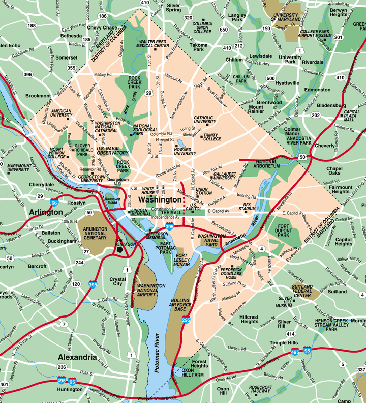
Washington, DC Metro Area Map

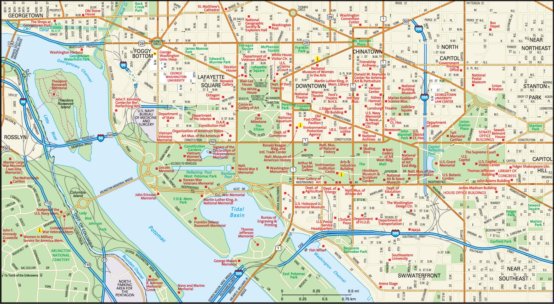
Downtown Washington, DC Street Map

Washington, D.C. is located along the Potomac River, between southern Maryland and northern Virginia. It is located 35 miles west of Chesapeake Bay and 50 miles east of the Blue Ridge Mountains. Winters are cold without being severe, with an average yearly snowfall of 16 inches. Summers are hot and humid.

The city is known for its striking Roman and Greek architecture, and also for its many museums, monuments, and public galleries. In the middle of Washington, D.C. is the National Mall, which comprises major monuments and open walking spaces, and is flanked by the Smithsonian Museum. Government offices and world-class hotels surround the Mall, making it an easy destination for visitors as well as those who work and live in the area. Most tourist destinations are accessible on foot.
The city is divided into four quadrants from the Capitol building, with alphabetical streets running east to west and numbered streets running north to south in a grid pattern.
Suburbs surround the city on all sides, including those located in Fairfax County, Prince William County, and Loudoun County. The commercial corridor of the city houses large-scale organizations including Nextel, AOL, Oracle, IBM, Siebel, and Accenture. Industrial areas are located east of the city.
|
Cherry Blossoms in Washington, DC
|
Because of the prominence of the U.S. government, a well-educated citizenry has resulted in cultural assets including arts, entertainment, and dining. Georgetown University, one of the country's most prestigious institutions of higher learning, is located within city boundaries. However, there are areas of Washington, D.C., particularly those located in the north and east, that are economically disadvantaged.
Washington, D.C. can be easily reached from anywhere in the world via Dulles Airport. There are many public transportation options, including the Metrorail, not only in the local area but also extending out into the suburbs. The I-495 freeway, also known as the "Beltway," makes it easy for drivers to navigate the downtown area.
In-depth information and news about Washington, DC can be found on these regional Washington, DC Directory, Washington, DC Libraries, and Washington, DC Newspapers pages, respectively.
All rights reserved. About us.
The Washington, DC metro area map is © Globe Turner.
The downtown Washington, DC street map is © Globe Turner.
The Washington metropolitan area map is © Map Resources.